Showing posts with label Revolutionary War. Show all posts

Wednesday, January 1, 2014

The Graveyard in 2014

Today I decided to walk over to the graveyard to see how my old friends were doing in the New Year. This March, it will be 241 years since Isaac Lounsbury, owner of the oldest inscribed gravestone in the cemetery, was buried. I can't say his stone looks like new, but it certainly looks a million times better than it did before its restoration.

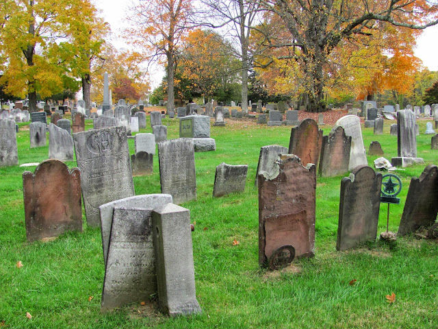
The cemetery itself is wearing its age well, too. The snow is gone (but not for long!) and while there is a lot more to do, the place has definitely benefited from all the work we have put into it over the past year. As you may recall, we had several restoration days over the spring and summer, and Hans has taken on the role of unofficial groundskeeper. The town has also been pretty good about removing the leaves that Hans gathered up throughout the fall.


Hans moved these stones back into alignment after one of them had shifted. I like how the surface of the granite is reflective at certain angles, and how the stones are smooth on top and rough on the sides.


Speaking of Isaac Lounsbury, here's his stone, looking better than ever. Thomas Brown (the carver) would be proud of the work that the Cornells have done. I have to say, though I love the 18th-century death's heads and cherubs, this stone is really beautifully done - it may even be the most beautiful stone in the cemetery (in my opinion, of course!). Its beauty lies in the simplicity of the design and its perfect execution.


Charles Haight is looking pretty good as well. Sadly, this stone will never look quite like it used to, but I think it looks as well as it possibly could given the circumstances. While no gravestone should be allowed to decay the way that Haight's stone did, it was especially unfortunate given the fact that Haight was such a great benefactor of St. George's. It was his land, after all, that the church and its graveyard were built upon.


But perhaps no one gave more for others than the soldiers buried in the southeast corner of the cemetery. Thanks to an incredible spreadsheet created by the White Plains Historical Society, I can tell you which people could be buried beneath this marker, but I can't be more specific than that. Other historical societies have been successful in identifying the soldiers buried in nearby graveyards, and we are hoping that with further research we will be as well.


Many of the stones in the cemetery have lines of verse beneath their biographical inscriptions. I don't think I've seen any with as short a verse as this one, which I believe says "Jesus my all." A quick Google search revealed that "Jesus, My All" was the name of a hymnal written in the mid-19th century. Perhaps it was a favorite of Sarah Elizabeth Miller, who was born in 1809 and died in 1887.


Near to Sarah Miller's gravestone is this pile of broken sandstone pieces beside their base.


And not far off from that is the dig site itself. Can you spot Feature 1 (marked by stones), Feature 2 (marked by the pillar we removed from the ground), and the rectangular outline of the remaining pillars? I have to say that we left the place pretty neat! You'd hardly know that only a few months ago there were dozens of people with shovels, trowels, and screens all over the place.


On my way out I stopped by the gravestone of Enoch Greene to get a decent photo ...


... and at the gravestone of Susan Thorn to ponder: why does her stone, and that of her infant son Stephen Jr., face a different direction than her husband, Stephen Thorn? Susan, whose maiden name was Susan Weeks, died in 1852, as did her baby. Stephen died in 1891. I have theories about the patterns of stone orientation in the cemetery, but it's still mostly a mystery to me.


Monday, November 25, 2013

Berthier's Journal


Louis-Alexandre Berthier was an assistant quartermaster-general in Count Rochambeau's army who created a series of maps depicting the areas where the army camped from 1781 to 1783. Above is Berthier's map of North Castle, showing the meetinghouse (a.k.a. St. George's Church) and "Etang" (a.k.a. Kirby Pond, drained in 1888).

Here are some excerpts from Berthier's journal of 1781 describing the army's experiences at North Castle. While we don't fully understand the symbolism used in the map, it seems apparent from Berthier's description that the rows of squares along a black line shown next to the meetinghouse and in several places behind it represent encampments.
2 July 
The Second Brigade left Newtown and marched 15 miles to Ridgebury, where it arrived at eleven o'clock. It was preceded on its march to the camp by an advance detachment of grenadiers and chasseurs. I was ordered to lead them and to choose a good position for them a mile ahead of the brigade on the road to New York, where they camped after stationing sentries at all points leading in from enemy territory. Here we received a change of itinerary. The First Brigade, which was to have marched to Salem, had marched to Bedford instead, and we had received the same order, when suddenly at midnight there arrived from the General another order to proceed by a forced march to North Castle, where the whole army would be assembled.

3 July
The Second Brigade left Ridgebury at three in the morning and at one that afternoon arrived at North Castle, 22 miles away, where it joined the First Brigade, which had just arrived from Bedford.

The Fourth Division, which had marched without a day's halt from East Hartford, 92 miles away, made this last 22-mile march in excessive heat with a courage and gaiety in keeping with the ador of the French. As we approached the enemy I was sent forward with an escort to requisition wagons at the halfway point for the sick and exhausted men. Since we were now on the edge of enemy territory, I was ordered to seize by force whatever was not yielded voluntarily. Using both methods, I obtained everything I needed.

The grenadiers and chasseurs camped on a height to the left of the New York road in front of a pond that adjoins the North Castle meetinghouse. The rest of the army was encamped on high ground in back of the pond and the little North Castle River, with their left at the meetinghouse and their right resting on a wood. The position was an excellent one, since its left was protected by marshes and closed by mountains and woodland ...

North Castle has few houses, and they are widely separated. The headquarters was very poorly housed - just how poorly you will understand when I tell you that the assistant quartermasters-general were obliged to sleep in the open on piles of straw, which was, to boot, rather too green ...

5 July
During the 4th and 5th the army made a halt at North Castle. General Washington came to visit the Comte de Rochambeau and passed down our lines. The troops were drawn up before the camp in line of battle without arms and wearing forage caps.
The soldiers of Rochambeau's army would have looked something like this (illustration from The American Campaigns of Rochambeau's Army, Volume 1, translated and edited by Howard C. Rice Jr. and Anne S. K. Brown).


The following illustration was drawn by Jean-Baptise Antoine de Verger, a sublieutenant in the Royal Deux-Ponts Regiment of infantry, and shows American foot soldiers at the time of the Yorktown Campaign (1781). Left to right: black light infantryman of the First Rhode Island Regiment, musketeer of the Second Canadian Regiment, rifleman, and gunner of the Continental Army (also from The American Campaigns of Rochambeau's Army).

Wednesday, November 20, 2013

The Burning of Bedford


The letter above was written by Lieutenant Colonel Banastre Tarleton to Sir Henry Clinton, the British commander in chief, on July 2, 1779, just before Tarleton's raid of Pound Ridge and burning of Bedford. The first few lines are the most notable to us: "I have the Honor to inform your Excellency, that I moved with the Detachment you was pleasd to trust me with, at half past eleven o clock last Night: - The Weather being remarkably bad prevented my reaching North Castle Church before four o clock next Morning."

The North Castle Church, of course, was St. George's.

Tuesday, October 29, 2013

Sparta Cemetery and the Leather Man

Our last stop of the day was Sparta Cemetery, site of the graves of Revolutionary War soldiers, a gravestone that was struck by a British cannonball in 1780, and the grave of the Leather Man. The Leather Man is a pretty well-known historical figure in these parts. After decades of walking on a 365-mile, continuous loop through New York and Connecticut, he died in 1889 and was buried on the edge of Sparta Cemetery. In 2011, people attempting to exhume the Leather Man's body to give him a more proper burial and possibly test his DNA found nothing in the place where he was supposed to be buried. They put up a new marker anyway, which we found covered in offerings for the Leather Man.


This stone caught our attention as we were leaving. It was obviously not made by a professional, but was inscribed with the name John Brenegen (?) and the date 1855 or 1856. It also has some recent offerings.


This is a lovely image in sandstone of an eagle pelican feeding its chicks in a nest; my mother recognized it as an old symbol that predates Christianity but was adopted as a symbol of Christ's sacrifice.


And here's an example of a sandstone where the deceased's initials were substituted for the cherub motif: Daniel Miller, who died as a child in 1775.


Lastly, a cherub with fine strands of hair, much like this grave in the St. Mark's Cemetery.


Elmsford Colonial Cemetery

Today Laurie and I went on another eighteenth-century adventure. Our first stop was the tiny graveyard in Elmsford known as the Colonial Cemetery. The church in the picture above is the Elmsford Reformed Church, which was built in 1783. All of the gravestones are quite far away from the church, perhaps twenty or thirty feet, and the eighteenth-century stones are widely dispersed. Also, all of the eighteenth-century stones face out towards the road, that is, in the same direction that the church faces.


You can see in the photo below that the stones along the front wall of the cemetery are tipping over and some are quite close to falling down onto the sidewalk below. One has already fallen and broken into several pieces.

Here's one leaning stone that I was able to photograph by getting down onto the sidewalk: Lydia, wife of the Reverend John Townley, who died in 1795 age 50.


 Here's another view from the sidewalk, showing the leaning stones and a part of the stone that fell.

And here's a lovely, relatively well-preserved urn and willow on the grave of Sarah Van Wart, who died age 27 in 1839.


Sarah's stone stands beside the monument to Isaac Van Wart, one of the captors of Major John Andre (Andre passed St. George's Church twice in September 1780 as a prisoner of war.)


Lastly, here is a general view of the cemetery with the church in the background. One interesting thing we noted is that while the eighteenth-century stones face the road, a few stones from the 1830s were faced in the opposite direction. Later stones again turned toward the road.


Tuesday, October 22, 2013

Eighteenth-Century Field Trip Part 2: St. Peter's Episcopal Church in Van Cortlandtville


St. Peter's Episcopal Church, pictured above, was the one church we saw that actually dated from the period of its earliest stones. It was built in 1766 (St. George's was built in 1761) and is only slightly smaller than St. George's was (28' x 36' versus 30' x 40'). What's more, I think it probably reflects the character that St. George's would have had as a simple country church way out in the wilderness of Westchester County.


Like St. George's, St. Peter's also served as a military hospital during the Revolutionary War. While some of Rochambeau's soldiers may have been buried at St. George's, eight named soldiers of Rochambeau's army were definitely buried at St. Peter's.


Other interesting comparisons between St. George's and St. Peter's: St. Peter's has a granite foundation, and all of the rocks we have found in STP 3 (the possible foundation wall) are granite; St. Peter's roof has slate shingles, and slate shingles have been found in Feature 1. We have been working off the assumption that the foundation wall in STP 3 and the artifacts from the dry well all represent material from St. Mark's Church, but we don't know that for certain. Given the inclusion of eighteenth-century artifacts such as pottery and the gunflint, it is possible that they are from St. George's.

Also, as at St. George's/St. Mark's, a lychgate was added beside St. Peter's Church in the nineteenth century.

For all of these reasons, St. Peter's offers perhaps the best chance to understand what St. George's would have looked like and how the graves would have been placed in relation to it.


The graveyard at St. Peter's is much larger than St. George's/St. Mark's. The eighteenth-century gravestones are located in the back and to the side of the church, and all face the same direction as the church's entrance. The closest stones are located only a few feet away from the church, and the farthest are dozens of yards away. As at the First Presbyterian Church, the orientation of the first stones seems to have set the precedent for all later stones.

St. Peter's Cemetery also has a stone that is a dead ringer for Deborah Haight's:


As we explored the cemetery we came across the old receiving tomb, dated to 1888. To our horror, there was an old sandstone grave marker embedded in one of its walls (shown below, with the distinctive ridged pattern visible). The Victorians could be a pretty disrespectful bunch. I suppose we're not much better, though - I forget who it was who recently told me about a walkway he or she saw that was paved with eighteenth-century sandstones ...


Here's one last shot of St. Peter's Church and cemetery. I forgot to mention one more similarity between St. Peter's and St. George's - they are both Episcopal. I don't know enough about eighteenth-century churches to say whether that would have influenced the layout and design of the church and cemetery - any more than it would if they were Presbyterian or Baptist, that is - but it may turn out to be important.

Eighteenth-Century Field Trip Part 1: First Presbyterian Church in Yorktown


Today Laurie and I went on an awesome field trip to three eighteenth-century graveyards. Unlike St. Mark's Cemetery, each of these graveyards is associated with a church that is still standing, although only one was the original church. Our goal was to study the distribution and orientation of eighteenth-century stones around the church in order to gain some insight into where St. George's stood might have stood in our graveyard.


The First Presbyterian Church in Yorktown was founded in 1730, and the first meeting house was built in 1737. Like St. George's Church, it was used as an arsenal and a barracks during the Revolutionary War. The British burned the church to the ground in 1779, and a replacement was built in 1785. The church that stands today was built in 1840.


There are a number of eighteenth-century sandstones lined up along the western side of the church, and others are scattered throughout the graveyard, running to the back of the church. Assuming that the present day church was built on the same footprint as the eighteenth-century one (which is not necessarily the case), this would mean that the graveyard surrounded the church on two sides. Assuming that the stones are in their original positions, they would have all faced the church.


Like the sandstones in St. Mark's Cemetery, all of the sandstones in the Presbyterian Cemetery face west. The church itself faces south. The stones themselves are very similar - the cherub on the stone of Abijah Lee, below, resembles that on the stone of Deborah Haight.


Unlike those in St. Mark's Cemetery, all of the stones in the Presbyterian Cemetery face the same way. Assuming that the present orientation of the eighteenth-century stones represents their original orientation, this would indicate that later parishioners followed the example of the first parishioners of the church. In contrast, the eighteenth-century stones at St. Mark's Cemetery face west, while the later nineteenth- and twentieth-century stones face east - perhaps because the church that originally informed the orientation of the stones was gone.


This stone was particularly fascinating, not only because it has a death's head (all of the sandstones at St. Mark's belong to the cherub phase) but because it was restored by its owners' great-great-grandson.

Saturday, June 15, 2013

Home Cemetery, Kennebunk, Maine


Home Cemetery in Kennebunk is nestled between the main road and a dense thicket of trees. The most prominent structure in the cemetery is the elaborate iron fence surrounding the White family plot. Unlike other family plots I have seen, it seems to have been planned out in advance - that is, I believe that the stones were already there, or were about to be put up, when the fence was put in place.

Thursday, March 7, 2013

WPA Veterans Records

In the 1930s, the Works Progress Administration made a map of the cemetery and collected data on each of the veterans buried there. I've transcribed the information below; as you can see, one soldier from the Battle of White Plains is named (Johnson O'Dell). There are a few strange inconsistencies in these records, for example William S. Lane seems too young (born 1808) to have served in the War of 1812. I also don't believe it's a complete list, as it leaves out Albert S. and William H. Lane. You can see these and other WPA Veterans Records at the Westchester County Archives Digital Collections.

Jacob Conklin (1821-1881)
Civil War
NY Vol. Co. D-50th 
Enlisted August 19, 1862 at Union, NY
Discharged June 13, 1865
War record: Siege of Yorktown-Fredericksburg-Wilderness, Va.; Cold Harbor-Appomattox Cour(t?) [record is cut off]
Rank: Private

Benjamin Dutcher (1844-?)
Civil War
Co. E. Mil. 15th NYNG
Enlisted June 4, 1864 at Mamaroneck, NY
Discharged July 7, 1864
War record: Served at New York Harbor
Rank: Private

Joel F. Gilbert (1819-1879)
Civil War
U.S. Army 5th NY H. Art. Vol.
Enlisted December 30, 1863 at Tarrytown, NY
Discharged May 1, 1864
War record: Discharged for disability at Fort Marshall Md.-Harpers Ferry-Wilderness; Cedar Creek-Charlestown
Rank: Private

Stuart R. Hart (1839-1861)
Civil War
17th NY Inf Vols.
Enlisted May 7, 1861
Discharged June 24, 1861 (date of his death)
Rank: First Lieut.

Warren Hutchings (1793-1857)
War of 1812

John A. Lands (1838-1877)
Civil War
49 Inf. Co. C.
Enlisted August 10, 1861 at Portchester

Thomas B. Lane (1841-1887)
Civil War
Co. B 57 Inf.
Enlisted September 17, 1861 at Utica, NY
Discharged December 15, 1864
War record: Wounded in action Sept. 17, 1862 at Antietam, Md. also May 5, 1864 at the [Battle of?] Wilderness, Va.
Rank: Private

William S. Lane (1808-1890)
War of 1812

David J. Matthews (1844-1867)
Civil War
Co. M Vol. 6th Arty. NY
Enlisted September 30, 1862 at Yonkers, NY
Rank: Private

Johnson O'Dell
Revolutionary War
War record: Killed in Battle of White Plains

Washington B. Pullis
Civil War
58th Ill. Inf. Vols
Enlisted October 1, 1861
Discharged April 1, 1866
Rank: 1st Sergeant, 2nd Lieut., 1st Lieut., Captain-Major

Wednesday, February 13, 2013

4: Charles and Deborah Haight

Grave of Charles Haight
While Gilbert Marten may be the longest lived person buried in the cemetery, Charles Haight may be the oldest, having died on October 3, 1799, at the age of 88 years and 1 month, placing his birth somewhere in September 1711; he was born in Rye, New York, the son of Jonathan Haight and Rebecca Gannung. (His death and age were inscribed on his gravestone, which has since deteriorated considerably. Fortunately a transcription was made in 1914.)
Charles Haight is also remarkable among the people of the cemetery for another reason. A farmer,* he once owned the land that the cemetery now occupies. He donated it to the Episcopal Church in 1761, and they built a small wooden church. That building was damaged during the Revolutionary War, when it served as a hospital for soldiers, and was torn down in 1819. The photograph below shows the church that was built in 1850, which is now gone as well. (This post shows a picture of the inside of the Episcopalian Church that exists today.)
Episcopalian Church built 1850
Not surprisingly, Charles also served as a vestryman and warden of the church. His father Jonathan was a Quaker, although he is mentioned as "on Episcopal Church records 1752," according to the Genung Genealogy. I don't know if this means he converted or, like me, was a Quaker who just liked hanging out in the Episcopalian Church sometimes.

Grave of Charles Haight
Charles's mother Rebecca was a granddaughter of Jean Guenon, a Huguenot who married into a Dutch family. Her parents were Jeremiah and Martha Gannung. Her father, who was baptized in the Reformed Dutch Church in Manhattan, moved to Westchester in the 1720s.

Charles married Deborah Sutton, who was born around 1714, in 1734 in Hempstead, New York. They had three known children: Charles Jr., James, and Hannah. None of them are buried in the cemetery. Deborah, however, is buried next to Charles, having died on November 23, 1793 at the age of 78. Her grave is in much better condition than her husband's.

Grave of Deborah Sutton Haight
Both graves are notable for being two of the fourteen sandstone markers in the cemetery. Eighteenth-century sandstone graves in New York and New England are probably my favorite type of American gravestones. I didn't see any when I was in England, but a reliable source suggests that they are there too, and presumably before they were here. They're just remarkable. The faces are primitive, yet exhibit endless variation. As one person pointed out to me, the design around the angel head on Charles Haight's grave is like the sun's rays.

There are a lot sadder stories in the graveyard than Charles Haight's, but there are few sadder gravestones. Surely the stone of the man who gave the Episcopalian Church its first home in the town deserves better than to have his last monument crumble away. Eventually, sure, they'll all crumble away, but we can certainly fix some of the damage for the moment.

There are two other Haights buried in the cemetery, both very small children. I've yet to determine how (if at all) they're related to Charles. There are Haights all over the county, many of them Quakers.

The first is Nicholas Haight, the son of Nicholas Haight and Jemima Halstead, who died on June 8, 1791, at the age of three months and 21 days.

The second is James C. Haight, the son of Stephen P. and Mary S. Haight, who died on April 22, 1850, at age two years, one month, and seventeen days.


*On the plaque in front of the cemetery, he is identified as "Charles Haight, Esq." In the U.S. today "Esq." after a person's name indicates that he is a lawyer, but apparently in the past it was simply a way of acknowledging someone of high rank (and perhaps this is still true in the U.K.?).

Sources
Nichols, Mary Josephine Genung and Leon Nelson Nichols. Genung, Ganong, Ganung Genealogy: A History of the Descendants of Jean Guenon of Flushing, Long Island. Brooklyn, NY: A. W. Heinrich's Printing Company, 1906.