

Today marked a first in the history of the dig - the first field day conducted completely in the rain! We've had a few wet days before, but anything more than a light drizzle forced us to stop. Yesterday, knowing that the predicted rain was likely to interfere with our planned field day, Bruce drove to the Chapter's headquarters and retrieved this brand new pop-up tent, which John recently purchased. Thanks to Bruce's forethought we were able to work for a few hours on the foundation wall, during which we made some curious discoveries.
To begin with, this is what we have been encountering in this area of the site: lots of rocks, mixed together with mortar and architectural debris - mainly nails and slate tiles. While there are places where it appears the rocks were stacked on top of one another (mainly in Feature 4A), a lot of the rocks seem to be thrown together indiscriminately, with slate tiles crushed and wedged between them. Bruce suggested that the slate tiles were used as building materials in between the stones of the foundation wall, which Carol says is a possibility. Another possibility is that the roof caved in. The rocks could have become mixed with the slates during either the destruction or deconstruction of one of the churches.

We have several different events to account for in our reconstruction: the construction of St. George's Church (1761), the deconstruction of St. George's Church (1819 - the building was taken apart and the frame moved to a different site), the construction of St. Mark's Church (1852), the moving of St. Mark's Church (1916), as well as the many burials that took place between the 1770s and the 1940s which may have disturbed the distribution of soil and artifacts.

The picture above shows the slate and rocks emerging from the dirt. The slate seemed to be concentrated in one area - specifically the center of Feature 4B, where the rock wall (though it looks less like a wall on this side of the Feature and more like a random pile of rocks) continues. On either side of the rocks - that is, the northern and southern ends of the unit - there is dry, compacted dirt with a few rocks and some artifacts. I found quite a few nails - both handwrought and cut - in the northwest corner of the feature.

You can see that my feet are resting on the rock "wall" and that the slates are poking through the surface of the dirt right in front of me. Of the dozens of slates we uncovered today, we kept only those that exhibited a specific feature: drilled holes. These holes, which appear to be roughly square, would have been drilled prior to the attachment of the slates to the roof. The slates would have then been anchored to the roof with nails.

In this picture Don is working on screening artifacts underneath the tent. The outline of the rock foundation wall found in Feature 4A is visible in front of him (to the right in the picture). In addition to the slate tiles and nails already mentioned, we found pieces of mortar, some "fancy" glass, and pieces of a mason jar (glass rim and milk glass lid), as well as some very fine pieces of glass that Carol believes came from a lamp, and a few very small pieces of worked wood that may have come from a floor. How they made it into this pile of rubble is a mystery.
One piece of mortar had an indentation in it, indicating where a nail had been set:

Shortly after we began working it became clear that we would benefit from the use of a second screen - but space beneath the tent was limited. Bruce and Carol helped to rig up an addition to the tent using one of the tarps.

Afterwards, we screened artifacts in the makeshift tent addition. That's not a dead tree on the right; it's a branch that Laurie found in the back of the cemetery and we used to prop up the tarp. We're like archaeological MacGyvers. (Well, not so much me, but the others are.)

The "foundation wall" seems to open up more questions with every layer of earth we uncover. We realize just how little we really know about the placement of the churches in the cemetery. What we do know (basically):
-St. George's Church stood from 1761 to 1819 and had a footprint of 30' x 40'.
-St. Mark's Church stood from 1852 to 1916 and had a footprint of 30' x 50'. From photographs, it seems to have been centered in the middle of the property, just east of the row of spruce trees.
-St. George's Church described by the Rev. Thomas Dibble: "A very decent church for public worship, forty foot by thirty, with galleries, covered and closed it with cedar, and only laid the ground floor."
-St. Mark's Church described by the Rev. Robert Bolton: "It is a very neat church-like structure, and is pleasantly situated on the west side of Kirby's pond ... The building was much admired, as a beautiful model for a country church. It is fifty by thirty feet, with a tower projecting eight feet in front, and is constructed of the best materials in a substantial manner."
What we don't know:
-Whether the footprints of the buildings overlapped.
-Whether one or both of the buildings had a basement.
-Which direction St. George's Church was oriented, or any other details of its construction or appearance beyond those described by Dibble.
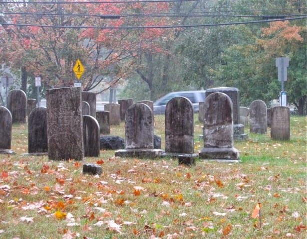
To end for today, here are some lovely pictures of the cemetery in the rain, taken by Laurie. A few of these stones have been newly reset, including the child's sandstone grave marker on the far left of the first picture.

It might be a reflection of my impoverished lifestyle, Maddie, but your posts have become the highlight of my day. Have you considered self-imposed quarantine? I do believe you have a bad dose of infectious enthusiasm. So...
ReplyDeletePic 2: What's the little orange thing, bottom left corner? I got fed up with staring at it, trying to work out what it was.
Pic 4: If you fail at archaeology, rest assured you have a ready made career as a garden gnome. Quite delightful.
Re. the slates with holes: Have you found any lengths of wire? It's just that I lived in a house with a slate roof once, and was woken in the early hours by the sound of a kid playing a tin drum close by. I made enquiries and was told that it was sometimes the habit to attach slates with wire instead of nails. There was a gale blowing off the sea that night, and the slates were apparently rising and falling on their wire 'hinges.'
Do you have reason to doubt that St George's would have been aligned east-west? In 1761 it was presumably built by British colonials, and all the old churches I've seen in Britain are aligned east-west with the altar at the east end. The graves are also aligned the same way (except Molly Leigh's in St John's, Burslem, but that was because she was thought to be a witch.).
Little orange thing - do you mean the handle of the trowel?
ReplyDeleteWe have found wire, but only in the dump site in the back. The drill holes in the slates are square and seem to match the size of many of the hand-wrought nails we have found, which is why we figured they were attached with nails. But I really like the idea of hearing the slates on a roof clattering on their hinges. It would be a very specific sound I imagine.
You're right that the church probably would have been aligned east-west, as the early graves are. What I should have said is that we don't know whether it was the long end or the short end that was the facade. In St. Peter's Church in Van Cortlandtville (built 1766), the front door is on the long end. In the Elmsford Colonial Church (built 1783), the front door is on the short end. There are probably better terms for these things than I'm using but you get the idea. It would be easier to plot the possible footprint of the church if we knew whether what we are digging might be the 30' wall or the 40' wall.
Ah, right... I was mistaking the blade of the trowel for another piece of rock.
ReplyDeleteMore thoughts on the alignment of the building:
It seems to me that you can assume with near-certainty that the altar would have been at the east end, and I've never known a rectangular church which didn't have the aisle running the length of the building. If your wall runs east-west, therefore, it's almost certainly the 40ft one. Couldn't your little college lend you some geophys equipment? Having said which, 40ftx30ft seems an odd shape for a church built with British precedents in mind. It's wider than we're used to seeing, so who knows? Are there no aerial photographs of the area in an archive somewhere? Might offer a clue with a keen eye.
I've thought about trying GPR (ground penetrating radar), but even if I was able to convince someone to lend us the equipment, cemeteries are notoriously difficult subjects - there's just too much disturbance. But it's a possibility. Since we've located one part of the foundation wall it might be useful to try some less high-tech methods, like probing.
ReplyDeleteDibble's account is the only source of the 30' x 40' dimensions. St. Peter's Church in Van Cortlandtville is about the same size. I wrote a post about it here:
http://episcopalcemetery.blogspot.com/2013/10/eighteenth-century-field-trip-part-2-st.html
St. Peter's is aligned east-west, but weirdly enough, the door is on the south side. It makes me very confused!
I have seen aerial photos of the town from the mid-20th century but the resolution is not great. Google Earth's are better but still rather inconclusive. I played around with some of them here:
http://episcopalcemetery.blogspot.com/2013/06/satellite-images-of-cemetery.html