
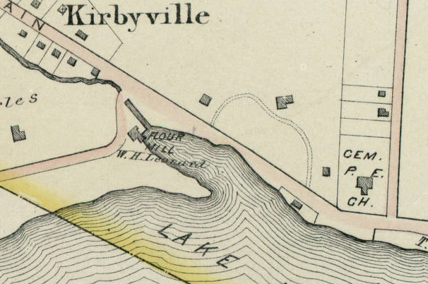
In the 1893 article about the di Cesnola graveyard controversy, the location of the graveyard is described thus: "Down at the southerly end of this pond there jutted out into it a little wooded peninsula which for over two hundred years has been used as a burying-ground."
This peninsula can be seen in the 1881 map of Kirbyville, not far from the old Kirby flour mill. Note St. Mark's Church in the right-hand corner of the map.

Some version of this house seems to have been standing in 1929. Interestingly, the property line seems to echo the shape of the peninsula.

As for the satellite image of the area today - it is difficult to say, but it seems likely that the graveyard (if any of it remains) is in this general area.

No comments:
Post a Comment